The Metropolitan Council’s work originates from the Metropolitan Land Planning Act (§473). There are several responsibilities outlined in statute that the Council must fulfill. They are:
-
Develop a comprehensive development guide for the metropolitan area.
-
Adopt long-range comprehensive system plans for transportation, wastewater treatment, parks, and water resources.
-
Carry out planning activities addressing the water supply needs of the metropolitan area.
-
Review comprehensive plans of local governmental units.
-
Provide services for and assistance with comprehensive community planning.
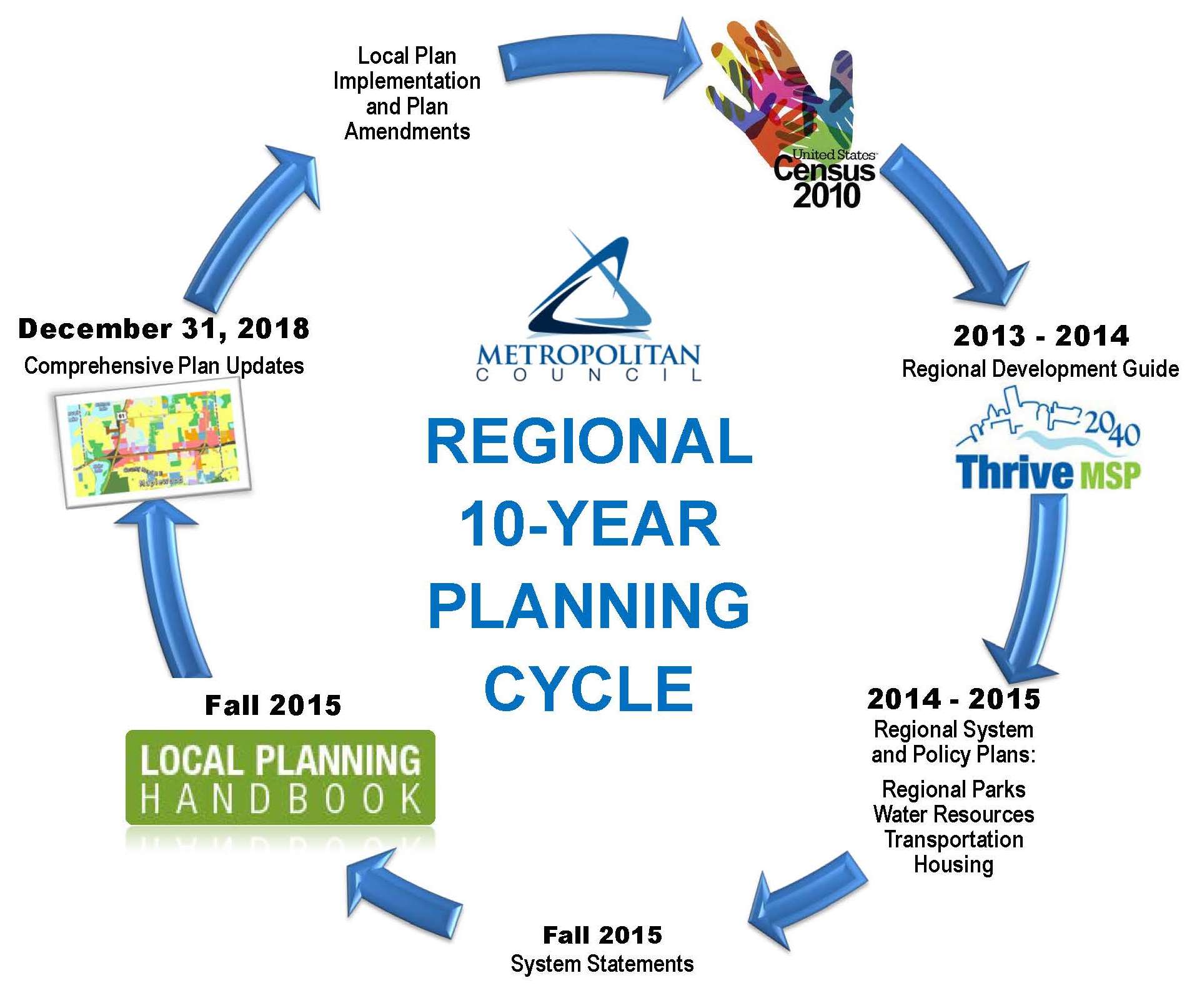
All incorporated cities, counties, and townships within the seven-county metropolitan region must prepare a comprehensive plan and update that plan every 10 years.
The regional planning process starts after the U.S. decennial census is complete. This information, along with the most recently adopted local comprehensive plans, informs the regional development guide which sets the vision and land use policies that are carried forward in the regional system and policy plans.
Regional Development Guide

The Council adopted Thrive MSP 2040 as the new regional development guide on May 28, 2014. Thrive identifies five outcomes that set the policy direction for the region’s system and policy plans. Building on our region’s history of effective stewardship of our resources, Thrive envisions a prosperous, equitable, and livable region that is sustainable for today and generations to come. The Council is directing its operations, plans, policies, programs, and resources toward achieving this shared long term vision.
Three principles define the approach to implementing regional policy: integration, collaboration, and accountability. The principles define the Council’s approach to policy implementation and set expectations for how the Council interacts with local governments.
The land use policies in Thrive establish a series of commitments from the Council for local governments and uses community designations to shape development policies for communities. Community designations group jurisdictions based on Urban or Rural character for the application of regional policies. Together, the land use policies and community designations help implement the region’s vision by setting expectations for development density and the character of development throughout the region.
System and Policy Plans
The system and policy plans were adopted after Thrive throughout late 2014 and in 2015. The systems plans include the 2040 Transportation Policy Plan, the 2040 Regional Parks Policy Plan, and the 2040 Water Resources Policy Plan. Statutes define these three areas as regional systems and direct the Council to plan for them, as well as operate or fund the system. The System Plans lay out needs and opportunities with respect to Council’s services, provide guidance in managing systems, and specify fiscal implications of these policies.
The policy plans include the Housing Policy Plan and the Master Water Supply Plan. The policy plans establish a shared vision for issues that are important regionally, but are not considered a regional system. These plans include technical information and recommendations to establish a regional direction and better address regional resources.
The system and policy plans identify strategies, policies, and methods designed to implement the regional vision outlined in Thrive MSP 2040.